Let Talk
Got a project or want to learn more?
Jump on a call or book a meeting.


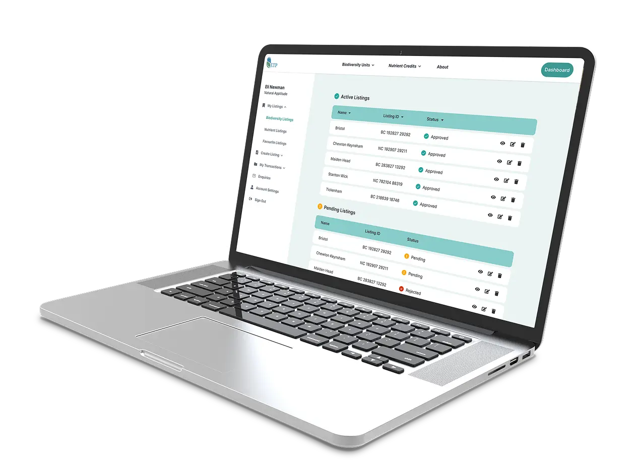
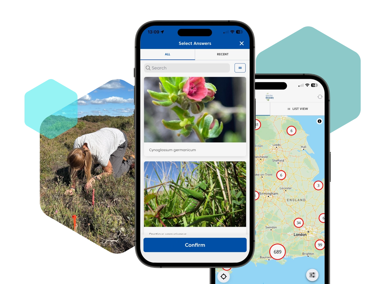
INNS Mapper is an free to use app and website for the reporting of sightings, surveys and management of INNS (Invasive Non-Native Species) in England, Wales and Scotland. By encouraging everyone to log their findings of invasive plant and animal species it aims to provide an effective resource to support INNS programmes and coordinate efforts to tackle invasive species in the UK.
A consortium including Yorkshire Water, Yorkshire Wildlife Trust, North Wales Wildlife Trust, GB Non-Native Species Secretariat (NNSS) and the National Biodiversity Network (NBN) joined forces to find the best way to tackle this growing problem.
The consortium wanted to find a quick and easy way for a wide range of people, including the general public, to record the occurrence of invasive species as well as enabling the reporting of invasive species management work.


The app also contains a number of new features such as the ability to record routes and non-occurrence. Both the app and website allow citizen scientists to help verify the data being collected by checking the photos submitted with records.


“INNS Mapper will provide an easy way for people to report sightings, surveys and management of invasive non-native species in England, Wales and Scotland. The ability to record management alongside sightings and surveys will allow for the dissemination and coordination of INNS management across catchments and regions.”
Dr Steph Bradbeer, invasive species and biosecurity ecologist at Yorkshire Water
“We are extremely optimistic and delighted about the launch of this app, which will get people across the country involved in spotting and recording any invasive non-native species they find, to help build a picture of distribution. This will help to join up and coordinate efforts across larger areas more effectively.”
Alex Green, INNS and biosecurity officer at Yorkshire Wildlife Trust


“INNS Mapper will provide an easy way for people to report sightings, surveys and management of invasive non-native species in England, Wales and Scotland. The ability to record management alongside sightings and surveys will allow for the dissemination and coordination of INNS management across catchments and regions.”
“INNS Mapper will provide an easy way for people to report sightings, surveys and management of invasive non-native species in England, Wales and Scotland. The ability to record management alongside sightings and surveys will allow for the dissemination and coordination of INNS management across catchments and regions.”
